Project #16 - Sturgis Sign
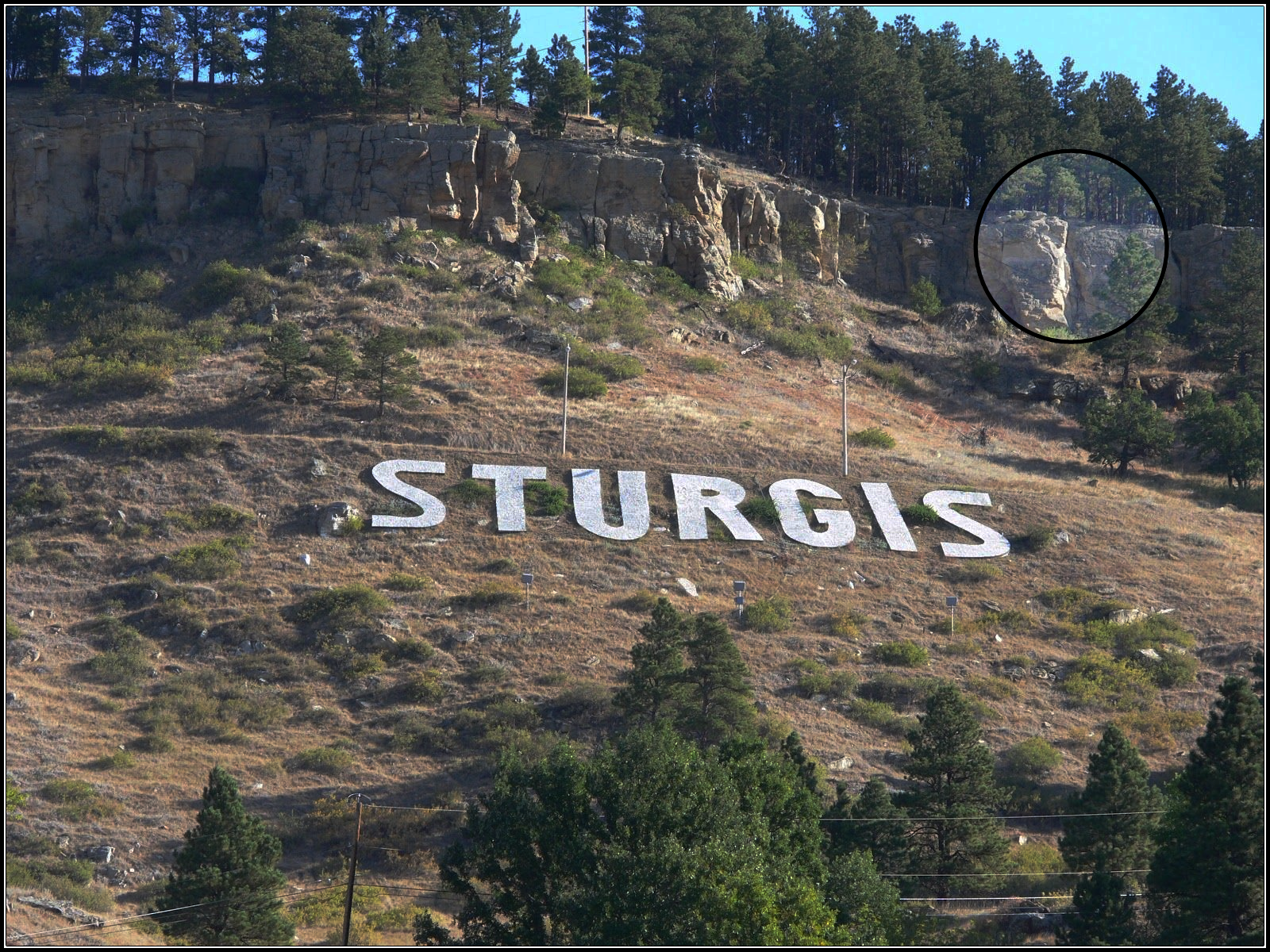
This postcard was photographed from the rocky cliffs of “Sly Hill” above the Sturgis area.
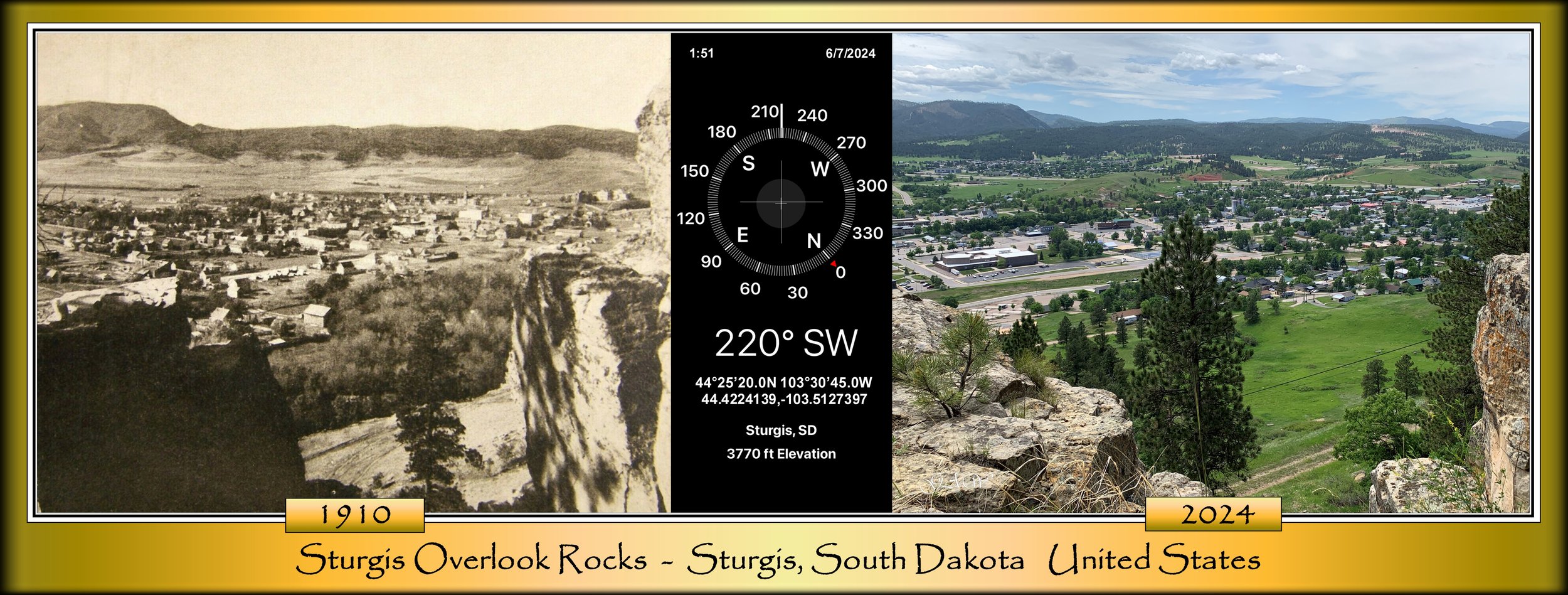
In the late 1800s through the early 1900s, several photographers traveled widely using the new mobile photography technology of the time. They often chose elevated locations, such as hilltops, to capture wide panoramic views and dramatic vistas.
Over time and through seasonal changes, this location has continued to shift, with large sections of the rock face breaking away and accumulating at the base below.
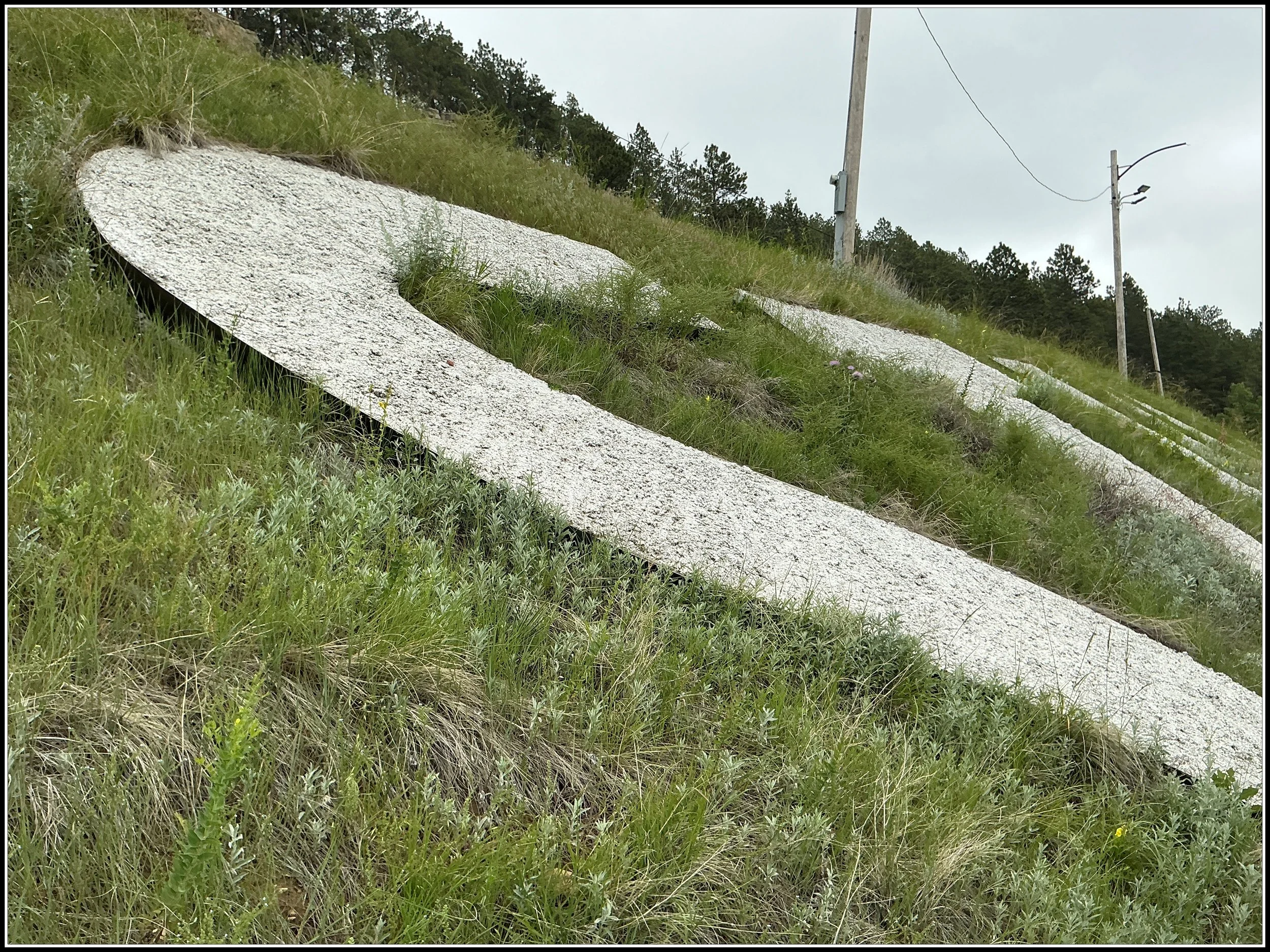
In the early 1940s, Mr. Lutz constructed the first sign by placing rocks individually, then painting it white. From that point, its history began.
Later, the sign was rebuilt as a poured concrete design and has since been maintained by trail enthusiasts along with community volunteers.
Note: This is private property, and public access is restricted.
Fun Nuggets: